
Survey Grade Utility Mapping for Cities and Municipalities
Underground Utility Mapping with Survey Grade GPS/GIS Systems
Omega Mapping Service provides survey grade GPS/GIS utility mapping for cities and municipalities. Our team understands the importance of having an accurate rendering of subsurface pipes, cables, storage tanks, and more. By integrating GPS positioning in conjunction with GPR and radio detection, Omega Mapping Service can locate and record underground utilities to obtain The American Society of Civil Engineers (ASCE) Quality Level B surveys and create network level SUE maps.
Unknown Subsurface Utility Infrastructure
Omega Mapping Service uses a survey grade GPS/GIS system to map utility locations. These utility maps help to avoid the wasted time and money that can come with unreliable “as-built” drawings from utility companies. In many cases these sets of drawings are outdated. Quite often they do not include lines of service that have been abandoned, updated, or moved.
Running into unknown underground utility infrastructure is common, and can be quite dangerous. Each year, according to the CGA, about 700,000 subsurface utilities are hit during digging and construction work in North America. In the United States alone there have been more than 2400 injuries, some fatal, caused by striking unknown utilities during excavations over the past 20 years.
GPS/GIS Survey of Subsurface Utilities
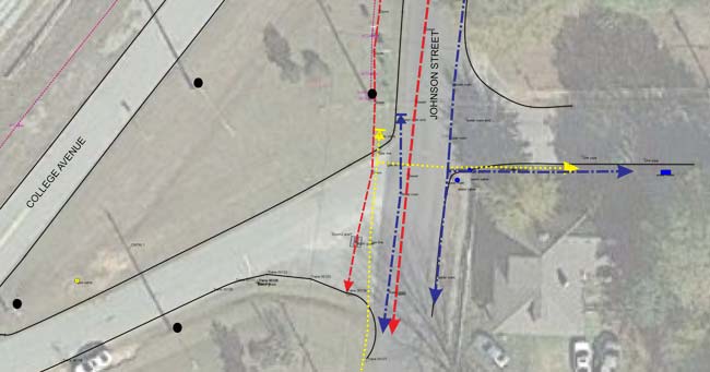
Omega Mapping Service uses Global Navigational Satellite System (GNSS) technology to accurately map the exact position of underground utilities in a city or municipality. Having a record of the exact location of subsurface infrastructure is critical for disaster planning and management, public and worker safety, and economic efficiency.
In a city development project, it is key that the precise location of underground infrastructure is available to bidding contractors. This will allow engineers to avoid underground utilities during the initial design phase and contribute to reducing unnecessary expensive utility relocation. Omega Mapping Service provides clear and concise survey grade utility maps that will greatly improve the overall cost-efficiency and timeline of a given project.
Signed and Sealed Utility Maps
Some projects require that the utility map be signed and sealed by a licensed surveyor. While Omega Mapping Service does not have a licensed professional land surveyor on staff, we can partner with local land surveying companies to assist with the deliverable portion of the work.
Omega Mapping Service will subcontract a local licensed land surveying firm to perform the utility mapping portion of a project to ensure that this occasional requirement can be fulfilled.
How Does Utility Mapping Work?
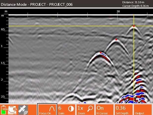
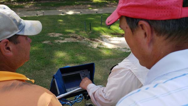
Omega Mapping Service uses state of the art electromagnetic and Ground Penetrating Radar equipment from the leading manufacturer. Our survey technicians are equipped with the TRIMBLE SERIES III Robotic Total Station and GSSI SIR 4000 High Performace GPR Controller. We scan the designated area to define the exact horizontal locations of each underground utility system.
Ground Penetrating Radar can detect:
- Metallic piping systems
- Nonmetallic piping systems such as PVC
- Electric cables
- Underground storage tanks
- Asbestos cement
- Concrete storm and sewer systems
- Buried structures
- Anomalies
- Other subsurface features
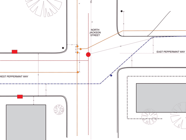
Once the horizontal location of the subsurface infrastructure is recorded, the corresponding Northing and Easting GPS points are collected. The GPS data collected is then converted into GIS data format and manipulated in GIS software. Omega mapping Service utilizes survey data to produce the survey grade utility map. Additionally, once the utility coordinates have been accurately recorded, they are marked using color-coded pavement paint and color-coded flags.
For more information on how Ground Penetrating Radar works, check out our page What is GPR?
Survey Grade Utility Mapping
Omega Mapping Service provides extremely accurate survey grade utility maps for cities and municipalities across the nation. Our state of the art GPR / GPS equipment ensures that the survey grade utility map provided to our clients will remain accurate almost down to the centimeter. Hiring a reputable GPR surveying company, such as Omega Mapping Services, to provide survey grade utility mapping for your city or municipality will save significant amounts of time and money, and will increase the overall safety of the people who live and work in the community.