
Rare Earth Finds; GPR in Archaeology
Ground Penetrating Radar (GPR)is a non-destructive form of geophysical surveying that allows archaeologists and researchers to identify and map historically significant archaeological sites without disturbing the ground.
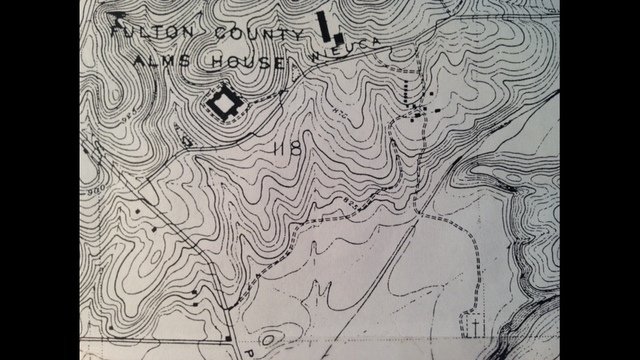
Locations that once held battlefields or ancient burial sites still hold many secrets and treasures buried beneath the soil. Prior to beginning an excavation, if the main goal is the preservation of the area, archaeologists and researchers will often have a geophysical survey done.
These surveys use various techniques including magnetometry, Ground Penetrating Radar, and electromagnetic (EM) surveys. Geophysical surveys are used to create subsurface images of an area.
Omega Mapping Service has more than a decade of experience in non-destructive, non-invasive geophysical testing. Having provided detailed maps for over 200 cemeteries across America; Omega Mapping Service has the right experience and equipment to create extremely accurate images of an area’s subsurface.
Archaeological Geophysics
Remote Sensing in Archaeology
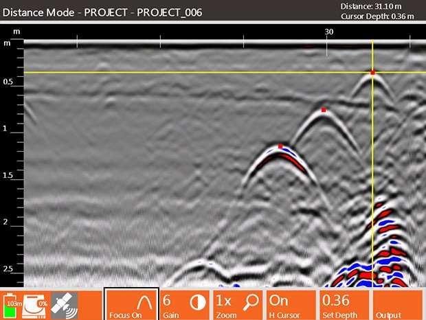
GPR surveys of historically significant locations reveal archaeological features hidden deep below the ground. GPR equipment does this by sending high frequency pulses into the ground and recording the time it takes to receive back the reflected pulse.
The GPR Technician guides the equipment along the ground in a grid-like pattern. Omega Mapping Service interprets the data and creates a detailed GPR map of the archaeological site. This allows the research team to pinpoint areas of greater potential.
Ground Penetrating Radar for Archaeology
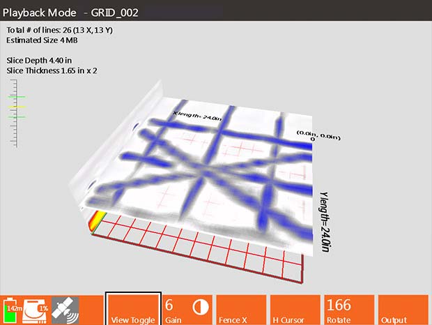
When requested by the client, Omega Mapping Service can perform a three-dimensional GPR grid survey, where each line of GPR data represents a profile view of the subsurface. When collected together these slices can be viewed as a three-dimensional map of the ground.
GPR for use in archaeology can also use a high frequency antenna to investigate historical masonry structures, detecting cracks and decay patterns of columns, and detachment of frescoes.
In archaeology, horizontal slices of GPR data, also known as time or depth slices, are most commonly used. This is because horizontal patterning is often the most important indicator of cultural activities.
For more information on Ground Penetrating Radar, check out our page What Is GPR?
Archaeologcal GPR System Surveys
GPR can be a valuable tool when it is used in favorable conditions, like dry sandy soils. Unlike other geophysical testing methods, Ground Penetrating Radar is unique in its ability to detect some small objects, such as stone tools or bullets deep below ground. GPR can also distinguish the depth of these objects with amazing accuracy.
Electrical conductivity plays a large role in the effectiveness of how GPR works for a given area. Ground Penetrating Radar anomalies do not display as clearly in clay rich or wet soils. Additionally; interpreting the GPR data is not easily done without specialized training, and considerable energy consumption occurs during extensive field surveys.
Rare Earth Finds with Ground Penetrating Radar
GPR is an extremely useful tool in the field of archaeology. Working with certified Archeologists, Omega Mapping Service’s GPR surveys create detailed maps of the subsurface which allows researchers to pinpoint areas of historical interest without causing unnecessary damage to the surrounding area.